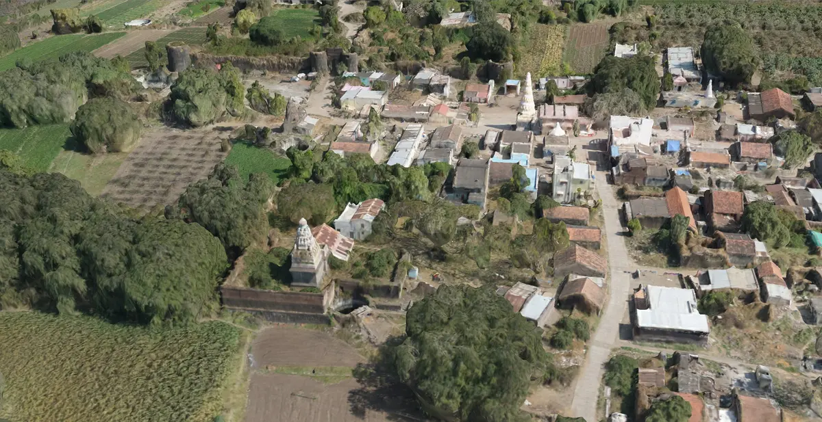
Schnell Drone Technologies Ltd. is India’s leading Drone-based service provider for Surveying & Mapping. Schnell is equipped with excellent drone infrastructure & team of highly skilled DGCA certified Pilots with experience in flying different kinds of UAV in different terrain & weather conditions.
1. Drone Infrastructure of Schnell Drone Technologies Ltd. for drone data acquisition –
Schnell’s drone infrastructure includes Micro category survey-grade drones equipped with an advanced mapping payload and state-of-the-art PPK Module. With flight time of 40 Minutes & operational range of 4 Km, such a UAV covers about 1 Sq Km in a single flight at 120 m AGL & offers category-defying performance even in the most demanding conditions. The combination of mapping payload with PPK module delivers accuracy that has never been seen before in this class.
The infrastructure also includes Small category survey-grade drones with an advanced mapping payload and state-of-the-art PPK Module. With flight time over 60 Minutes & operational range of 5 Km, such a UAV covers about 2 Sq Km in a single flight at 120 m AGL
Team of Schnell Drone Technologies Ltd. has carried out thousands of flights using these UAVs in different weather & terrain conditions across multiple states within India.
2. Drone data processing for Creation of ORI, 3-D dense point cloud, DEM, DTM & DSM-
While surveying with drones, images of the ground are taken from multiple vantage points. These images are processed using Image Processing Software for generation of ORI (Ortho Rectified Imagery), 3-D dense point cloud, DEM (Digitial Terrain Model), DTM (Digitial Terrain Model) & DSM ( Digital Surface Model)
Schnell Drone Technologies Ltd. possess all the expertise & experience in processing drone data for creation of ORI, 3-D dense point clous, DEM, DTM & DSM.
- Various outputs of Drone data processing
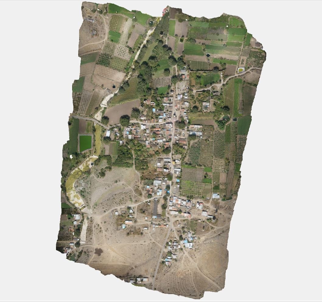
a. Ortho Rectified Imagery- Drone images are processed using Photogrammetry softwares such as Agisoft Metashape to create ORI i.e. Ortho Rectified Imagery. This is High Resolution Imagery which can be used for Digitization of Point, Line and/or Polygon features. It is also used in Legal proceeding & Court cases, It can be used for carrying out various kind of inspections in the specific areas such as encroachments, flooded regions or even deforested areas.
Schnell Drone Technologies Ltd. has executed multiple drone data processing projects for creation of ORI ( Ortho Rectified Imagery)
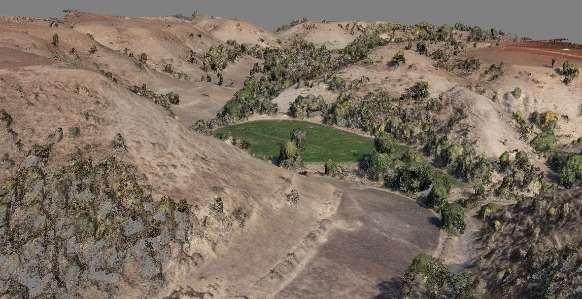
b. 3D point cloud- Such a point cloud can be used for generation of 3D textured models (City, Building or any object) & generation of contours. Classification of Points can be done using 3D Point cloud.
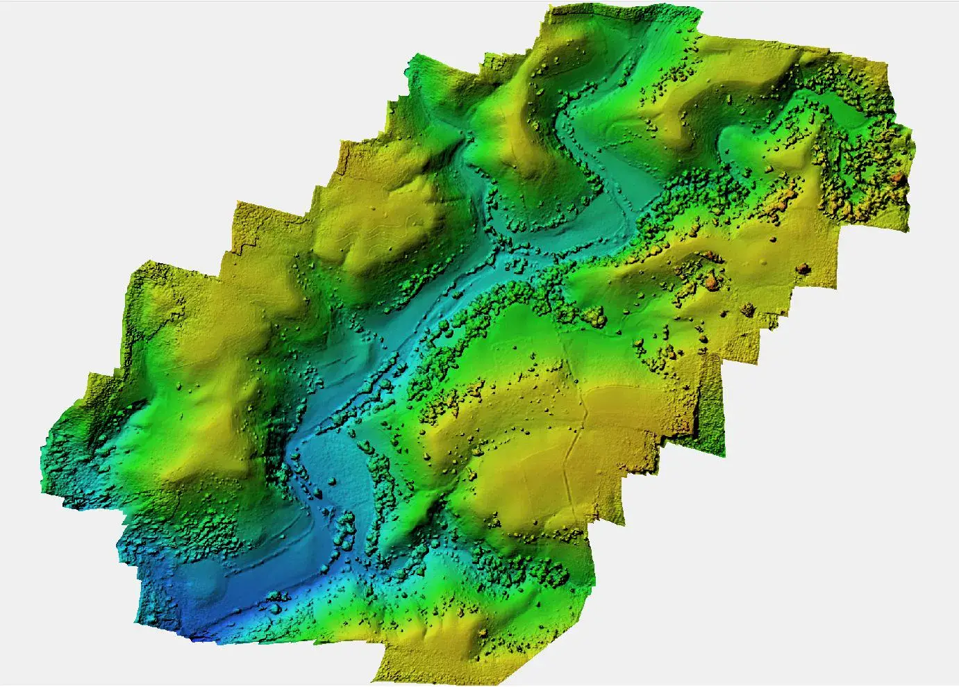
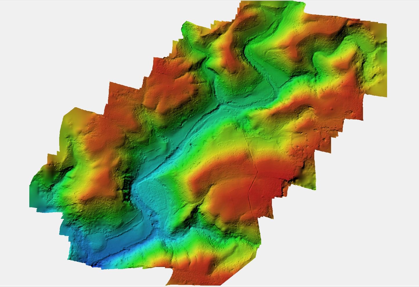
c. Digital surface models (DSM), Digital Elevation Model (DEM), Digital Terrain Model (DTM) – 3-D point cloud data is processed to create DEM, DTM & DSM. This 3-D data has extensive applications in various domains.
3-D data is used to create contours. It can be used to calculate Cut & fill Volumes specifically at the mining sites where excavation happens. Path Profile can be generated using this kind of 3-D data which is extremely useful for Infrastructure companies. Defense forces use such 3-D terrain data for deployment of forces in any desired region. Telecom companies use 3-D data for deployment of Telecom towers & to check network coverage of each tower. Utility companies use 3-D terrain data for setting up transmission lines.
d. Contour Maps - This proves to be useful for the selection of sites, finding general slopes of area, to determine the catchment area of a drainage basin, or to find intervisibility between two or more stations, mostly used by civil engineers in the construction of roads, highways, railway lines, water pipelines, etc.
Schnell Drone Technologies Ltd has carried out multiple Drone data acquisition & Drone data processing projects in various states of India.
Schnell team is actively involved in the SVAMITVA project which intends to cover about 6,60,000 villages across all the states in India using Drones. SVAMITVA (Survey of Villages Abadi and Mapping with Improvised Technology in Village Areas) is a Central Government flagship Scheme initiated by the Ministry of Panchayati Raj. It aims to give an integrated property validation solution for rural India and empowers them with the records of right to their residential properties. Schnell team has acquired data for more than 50,000 acres across 500 villages in Uttar Pradesh & Gujarat States. Schnell team has also done extensive acquisition of data for Maharashtra state Government in Latur district. This data was further utilized to map property tax payers in GIS.
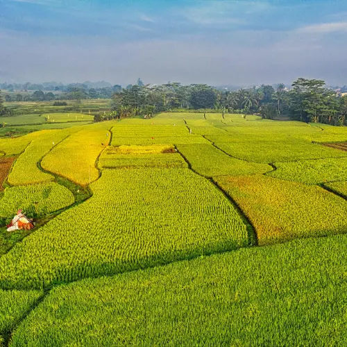
3. Multispectral Imaging using Drones / UAVs in Agriculture
“Multispectral Imaging using Drones” is a niche segment in Agriculture domain. “Schnell Drone Technologies Limited” has carried out multiple data acquisition & multispectral data processing projects. India, primarily being an agrarian economy, can reply upon this technology to bring in the next revolution. Multispectral drone imaging is revolutionizing the way we farm, making agriculture more efficient, profitable & sustainable. By providing detailed insights into crop health and conditions, this technology is helping farmers make more informed decisions and take proactive measures to improve their yields.
A standard visual sensor collects red, green and blue wavelengths of light. Multispectral sensors are able to collect these visible wavelengths as well as wavelengths that fall outside the visible spectrum which include near-infrared radiation (NIR), short-wave infrared radiation (SWIR) and others.
In the red edge band section of the spectrum, the first signs of stress can be identified. Sometimes this stress is related to disease. Using analytics generated with the red edge band, farmers can identify, monitor and track disease-related stress. This is how multispectral sensors can help farmers catch disease sooner and act faster to stop the spread. Various indices such as NDVI, NDRE, NDWI, GNDVI are immensely helpful in early decision making to increase the farm yield.
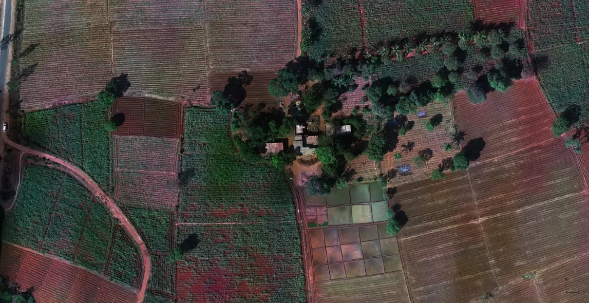
RGB data acquired using Drone / UAV
RGB sensors on drones capture images by combining red, green, and blue light at varying intensities, which allows for the reproduction of a wide spectrum of colors. This technology is fundamental to creating high-resolution, color-accurate images from aerial perspectives.
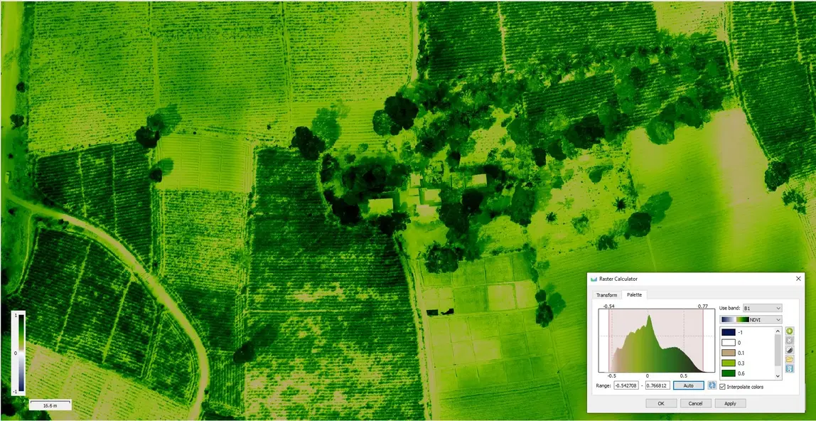
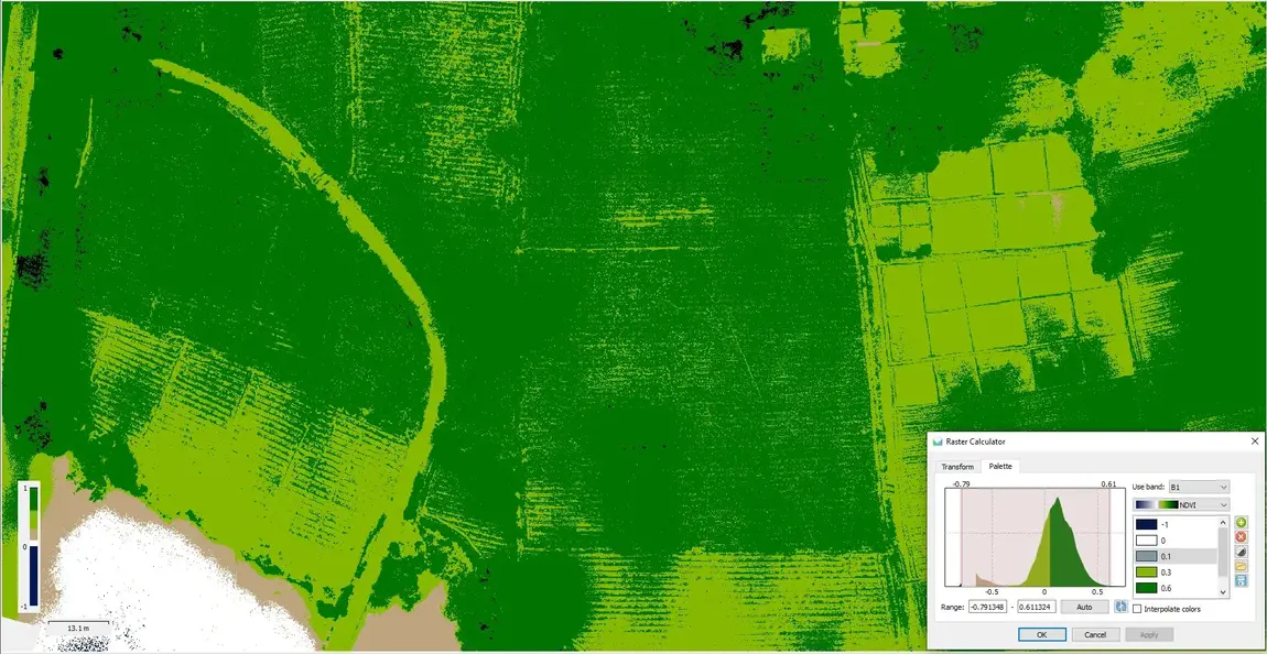
NDVI ( Normalized Difference Vegetation Index) analysis of Drone data
The normalized difference vegetation index (NDVI) is a widely-used metric for quantifying the health and density of vegetation using sensor data. It is calculated from spectrometric data at two specific bands: red and near-infrared.
NDRE (Normalized Difference Red Edge Index) analysis of Drone data
Normalized difference red edge index (NDRE) is a method of measuring the amount of chlorophyll in the plants. The best timing to apply NDRE is mid-to-late growing season when the plants are mature and ready to be harvested.
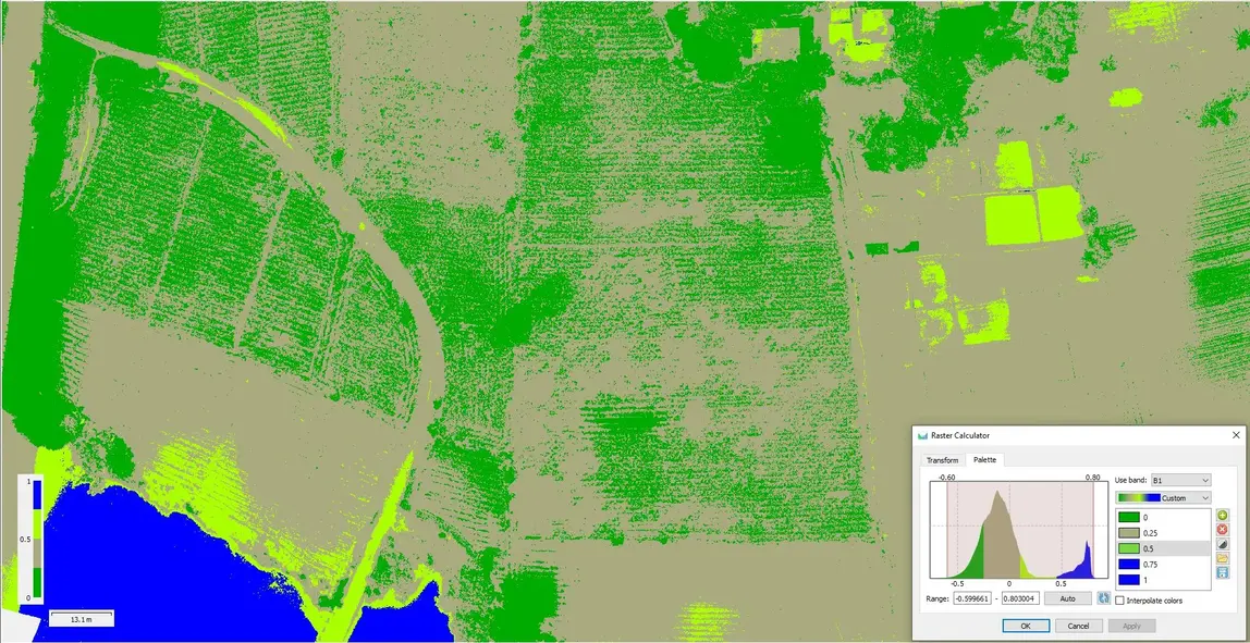
NDWI (Normalized Difference Water Index) analysis of Drone data –
The Normalized Difference Water Index (NDWI) is known to be strongly related to the plant water content. It is therefore a very good proxy for plant water stress. The Normalized Difference Water Index (NDWI) (Gao, 1996) is a satellite-derived index from the Near-Infrared (NIR) and Short Wave Infrared (SWIR) channels.
GNDVI (Green Normalized Difference Vegetation Index) analysis of Drone data -
The Green Normalized Difference Vegetation Index (GNDVI) method is a vegetation index for estimating photo synthetic activity and is a commonly used vegetation index to determine water and nitrogen uptake into the plant canopy.